Are
you getting tired of volcanic cones yet? Gee, I hope not.
Let's see, I've done Mt. St. John, and Mt. Hobson (in two parts) so far. That leaves
51 more to go!
Today's offering to you (What a switch, I'm offering a volcano to you. As you learned from my comments about Joe, of movie fame, generally it's done the other way around.) is Mt. Albert. This is the volcano in Auckland's field that is closest to our home in Henderson. Mt Albert is also one of the stops on the Western Train Line. It was also a Pa, although the evidence that it was has been mostly destroyed. The very top of Mt. Albert was removed over a period of years. It's rocks were used in a multitude of building projects and even for ballast in ships.
I read an interesting story about this Pa. It seems that this volcano, as it cooled and settled after the eruption, developed a tunnel. This is fairly common in this kind of volcano. (Rangitoto has some impressive ones.) This particular cave ran from near the top to a spot at the very bottom of the cone. The Maoris that lived on this Pa knew about the tunnel of course. The story goes that once, when they were attacked by a strong neighbouring tribe, the people escaped through the tunnel, all except the chief, who was too large to fit through its narrowest spot.
The story ended there. It did not go on to say that the chief fed the attackers that day, but from what I learned at Mt. Hobson, I wouldn't doubt it.
I had hoped that there would still be evidence of the tunnel and climbed the hill with high hopes. Unfortunately, I couldn't find one. I asked two different groups of people I met on the top of the mount if they knew of any tunnel. None of them did.
I think that the rock quarrying they did probably destroyed the thing, if it ever was really there.
So, let's go. You're lucky. This was a big hill to climb. Every step I took after leaving the train was up hill. You get to lean back and click to climb. Enjoy...
 I'm sitting on a bench in the downtown area, sipping on this explorer's favorite beverage, chocolate milk. Well, maybe not my very favorite one, but it's 11:00 a.m. What do you expect?

The moss growing on this wet sidewalk looked so vibrant, I wanted to show it to you. Doesn't show up in the photo quite as nicely as I would have hoped, but...

I've noticed at all the volcanic sites I've visited so far, that there are very nice homes on the slopes.

Here is another nice home. This shot shows the slope of the hill too. The top of the cone is in the background.

Finally at the gate.

This is an area just above the gate. It's one of the areas where rock was removed. It's now a soccer field.

This is an archery course.

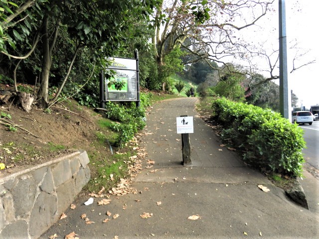
I'm heading up the road to the top

You've seen one of these markers on Mt. Hobson.

This sign is not in very good shape, but it does show the amount of rock removed.

Just
to the right of the centre of the picture, you can see a whitish
building with a tower crane sticking up above it. (No, that's not
Jeff. He's in Newmarket.**) That is in Glen Eden. Those are the
Waitakeres in the background. We live off to the right of that
building and about as far away again as Glen Eden is from Mt.
Albert.

I was surprised that I could see all the way to Manukau Harbor.

I've turned around now almost 180 degrees and can see Waitemata Harbor. I think you can see that it's low tide.

A nice picnic spot

It's hard to see the structure in this picture, but this is one of the few remaining terraced areas on this Pa.

I'm walking back down to the train now and pass this dry, stacked-stone wall.

Hey, look at this bench. It's terraced too!
Well,
I told you early in this adventure, that I was unsuccessful in
finding the Mt. Albert tunnel that led the Maoris to safety so long
ago. That is true. I was disappointed.
However,
I was mollified to some degree as I noted that Mt. Albert is not
today totally bereft of tunnels. The next two photos show you the
very efficient, and -wide- tunnel that gives access to the train
station. Even a plus-sized chief could negotiate this tunnel with
ease.


Attackers
today would not find anyone remaining behind to eat. They'd have to
make do with kumara.

This
concludes my series (for now) of posts about volcanoes. I'll no
doubt climb some more in the future. Mt. Wellington might be next,
but we'll see... -djf