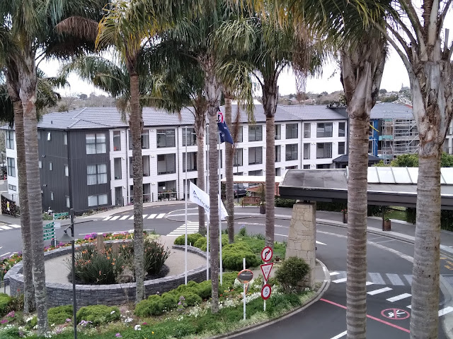
I've shown you quite a number of photos of Waitakere Gardens. They have been though, a hodgepodge of shots, supporting whatever topic I was talking about.
Today, I'd like to show you a map of the place and each building separately, so you get a better idea of the size and shape of our village.
This is the sign in the circle drive and front entrance.
Let's work our way down the sign and show you each building as we go. Check out the map below as you look at the buildings.
I wanted to give you the map as well, because in past posts, I talked about walking in the halls after dinner or on rainy days. If you look at the map again, you can readily see what a great walk we can have by first circling the open portion of the Atrium, and then proceeding through the Mews, the Ferns and finally to Rosecourt. We can then retrace our steps or use the stairs to get to another floor and work our way back to the Atrium. We could really make our hike long and complicated if we crossed the Sky Bridge, shown in blue on the map, and walked the floors/steps in the Vines.
The map also shows you the garden areas throughout the village. We have found that we can easily walk for 30 minutes, all outdoors and within the village. If we want to spend more time walking, we can simply repeat our route, but with variations.
There are about 310 residents. The village is gated and the carpark attached to The Vines, (see map) shares a common wall with the Henderson City Police Department carpark. It's a very safe place to live.
I've been impressed with the residents we've met here. It is a vibrant community whose population happens to be over 65 years of age. One new friend made his first skydive when he turned 80. We have a resident who sang opera during her career and who entertained at a women's dinner recently. There are a number of extremely talented artists and a published author.
Kiwis on the whole are a very well-traveled nation. I've listened to after-dinner stories about such diverse places as Scotland, the Cook Islands, and Egypt. Practically every Kiwi I've met has commented to me that they have visited America (sometimes multiple times) or have family living there now. I've especially enjoyed hearing the stories some have told of very positive experiences had while in the United States.
Well, I've tried in this post, to give you a better understanding of our new home. Maybe you can tell how impressed I am with it. I hope that we can contribute to it as we enjoy our golden years. -djf


I definitely have a better picture of your new home after seeing your tour of it. I did not realize it was a gated community and so near the police station. That is a wonderful thing to feel safe. I love the diversity of your home too and all the different people with such a varied background. I bet you are the only people from the U.P. of Michigan (God's country). It makes me so happy that you are all happy and safe in your new home. My prayers for you as we all weather the latest COVID wave. McKenzie
ReplyDeleteWe're not the only Americans, but we are certainly the only Yoopers.
ReplyDeleteI'm glad that you know more about where we live now. I should have done a post like this shortly after we moved in.
And thanks for the prayers, but we're doing just fine. No worries.
Thanks for all this helpful information about your village and the map! Finally after 2 weeks I carefully read this post again and kept flipping back and forth to the map.
ReplyDeleteAnd so now I understand how you can walk through almost all the buildings without going outdoors! So what's with Millbrook not being connected with the other buildings?
Also it seems like the Vines is off in its own little (semi) circle - makes me wonder if more apartments will be built there to complete it. (The lower right corner of the map does say: "There's more to come")
It's great to see where all the gardens are - but I'm wondering if the community and hydroponic gardens that Jeanne takes care of are labeled 'vege gardens' down by the Opanuku?
Finally - I'm surprised there are only 310 residents in your village! Maybe I shouldn't be because after all, look where I/we grew up.
Again, thanks so much for sharing!
Yes, the community and hydroponic gardens are next to the Opanuku.
Delete